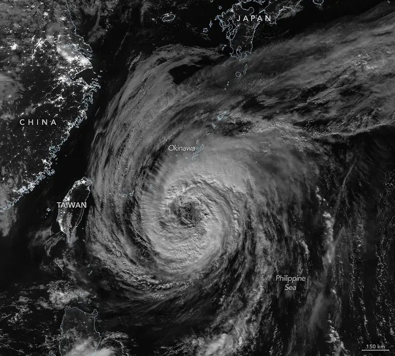
From late May into early June 2026, a broad, slow-spinning storm churned north-northwest over the Philippine Sea toward southern Japan. Typhoon Jangmi’s rainbands unleashed torrential rainfall across a vast swath of the region, triggering flooding concerns in several areas.
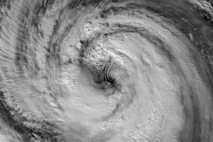
The VIIRS (Visible Infrared Imaging Radiometer Suite) on the Suomi NPP satellite captured this nighttime image (above) of the storm at about 16:40 Universal Time on May 30 (1:40 a.m. Japan Standard Time on May 31). Around that time, the typhoon produced sustained winds of 120 kilometers (75 miles) per hour, based on 1-minute averages reported by the Joint Typhoon Warning Center (JTWC). That’s equivalent to a category 1 storm on the Saffir-Simpson hurricane wind scale.
The image shows a detailed view of the eyewall and eye, with a diameter that is on the larger end of the spectrum, according to Scott Braun, a research meteorologist at NASA’s Goddard Space Flight Center. There is also an area of low-level rotation on the southeastern side of the eye, producing a feature known as a “mesocyclone” that is partially obscured by high-level clouds. Though they appear striking, the features are fairly typical, Braun noted.
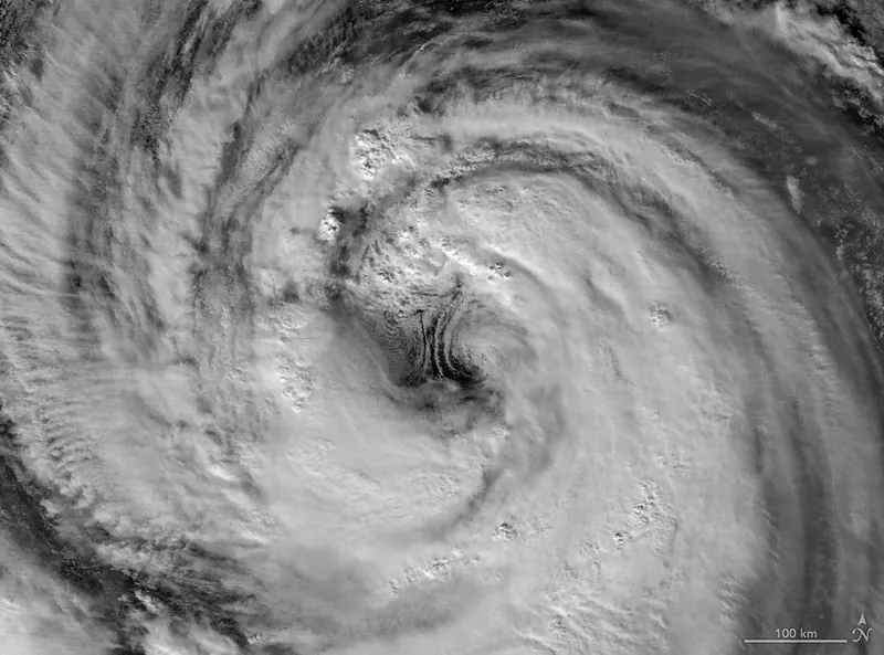
The second image shows a wider view of the same storm one day later. The VIIRS on the NOAA-20 satellite acquired this image at about 16:40 Universal Time on May 31 (1:40 a.m. Japan Standard Time on June 1), when the storm was a slightly stronger typhoon with sustained winds of 130 kilometers (80 miles) per hour.
In both images, Jangmi’s eye was still located south of Okinawa. However, the storm’s outer cloud bands already reached over land as the storm moved north. Forecasts called for the storm to make a close approach to Okinawa and then turn northeast toward the Amami region around June 1-2. It was expected to continue delivering large amounts of rain, especially along the nation’s Pacific coast, according to news reports.
NASA Earth Observatory images by Michala Garrison, using VIIRS day-night band data from NASA EOSDIS LANCE, GIBS/Worldview, and the Joint Polar Satellite System (JPSS). Story by Kathryn Hansen.
Downloads
May 30, 2026
JPEG (1.56 MB)
May 31, 2026
JPEG (2.48 MB)
References & Resources
- The Japan Times (2026, June 1) Tropical Storm Jangmi set to lash wide area of Japan. Accessed June 2, 2026.
- Joint Typhoon Warning Center (2026, June 1) Prognostic Reasoning for Tropical Storm 06W (Jangmi). Accessed June 2, 2026.
- The New York Times (2026, June 2) Tracking Tropical Storm Jangmi. Accessed June 2, 2026.
You may also be interested in:
Stay up-to-date with the latest content from NASA as we explore the universe and discover more about our home planet.
Tropical Storm Arthur
2 min read
The first named storm of the 2026 Atlantic hurricane season brought intense rainfall and the threat of flash flooding to…
Article
Explosive Intensification for Hurricane Polo
5 min read
Several ingredients came together off the Pacific coast of Mexico to generate one of the strongest storms the eastern Pacific…
Article
Lala Batters Hawaii
3 min read
The powerful storm delivered extreme rainfall and damaging winds to the state, passing the Island of Hawaiʻi as a category…
Article
1
2
3
4
Next
Keep Exploring
Discover More from NASA Earth Science
Subscribe to Earth Observatory Newsletters
Subscribe to the Earth Observatory and get the Earth in your inbox.
Earth Observatory Image of the Day
NASA’s Earth Observatory brings you the Earth, every day, with in-depth stories and stunning imagery.
Explore Earth Science
Earth Science Data
Open access to NASA’s archive of Earth science data
Source: NASA Science