Sept. 24, 2025
April 20, 2026
April 20, 2026
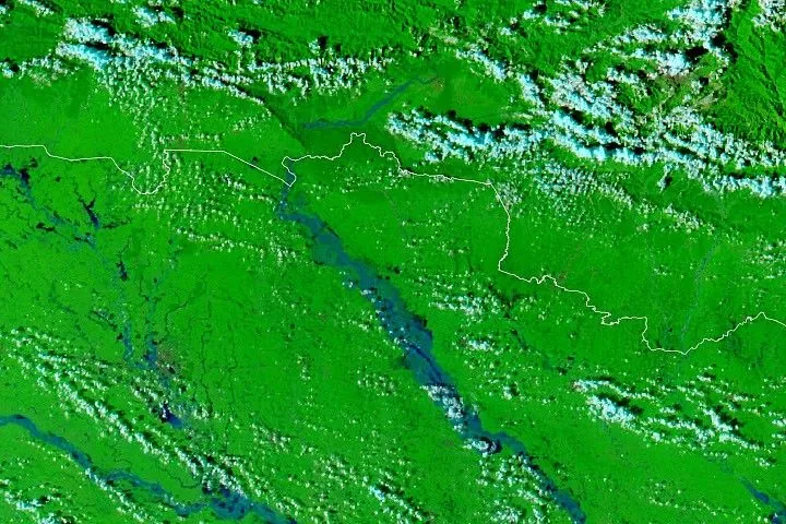
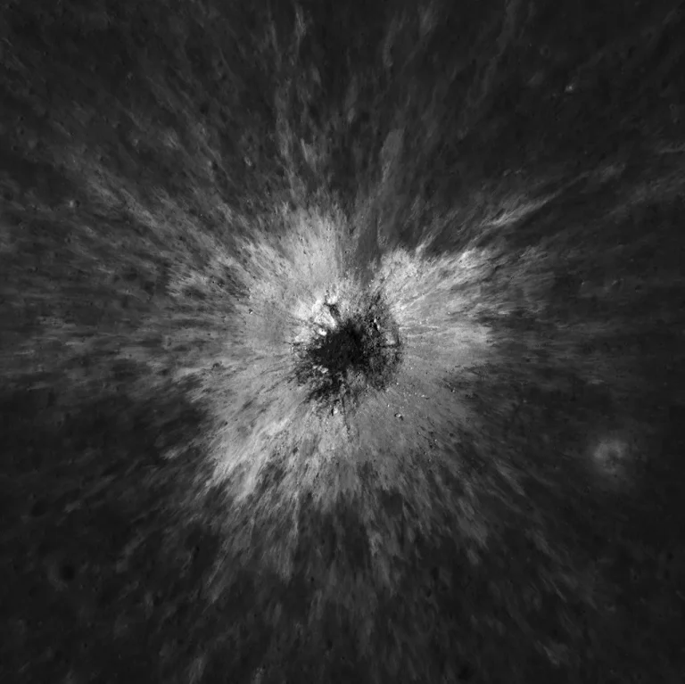
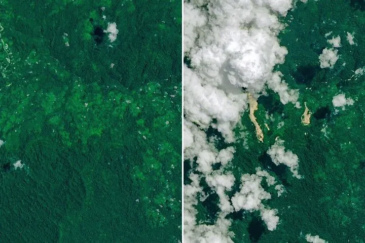
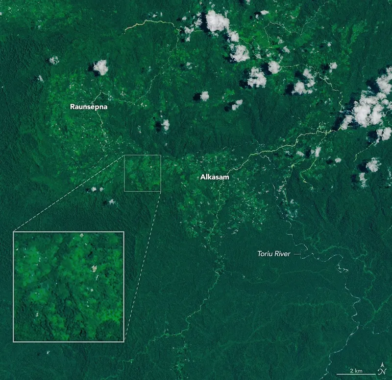
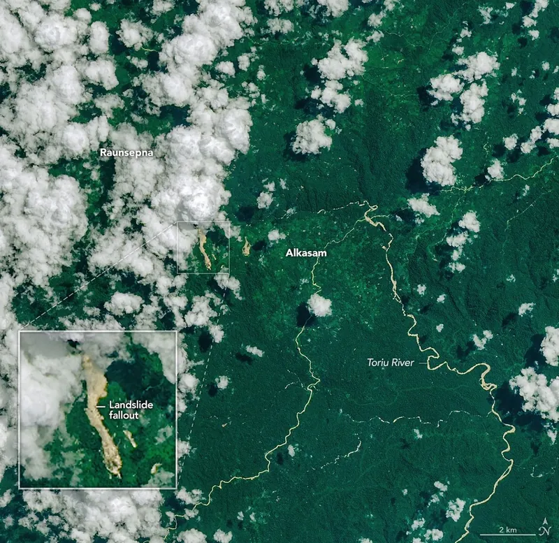
During a break in the clouds, the OLI (Operational Land Imager) on Landsat 9 captured an image of landslide fallout in the forested Gazelle district of East New Britain on April 20, 2026 (right). A second image from Landsat 9 shows the same area on September 24, 2025 (left), before the landslides.
Since much of Papua New Guinea lies close to the equator where the Coriolis effect is weak, the risk of tropical cyclones striking the island nation is relatively low, especially in its northern areas. Nevertheless, unusually warm sea surface temperatures and atmospheric conditions favorable to storm formation brought powerful Tropical Cyclone Maila dangerously close to the islands of Bougainville, New Britain, and New Ireland in April 2026, fueling intense rainfall.
The heavy rains saturated steep terrain in the Gazelle district of East New Britain, triggering landslides on and around April 9 that led to several deaths, according to news reports. The Landsat 9 satellite captured an image of the fresh landslide scars cutting through the dense tropical forests in the Baining Mountains on April 20, 2026. The Toriu River and other sediment-laden waterways are visible to the east of the landslides.
The landslides appear as light-brown swaths of exposed soil and debris extending north toward a nearby river valley, contrasting with the surrounding green vegetation and scattered white clouds. A second image from Landsat 9 shows the same area on September 24, 2025, before the landslides.
Maila was notable for its intensity—reaching Category 4 strength on Australia’s cyclone intensity scale (Category 3 on the Saffir-Simpson scale used for U.S. hurricanes)—and also for its slow movement near Papua New Guinea. Instead of passing quickly through the region, Maila lingered, allowing rainbands to repeatedly strike East New Britain. Satellite-based precipitation estimates from NASA’s Global Precipitation Measurement (GPM) mission indicate that hundreds of millimeters of rain likely fell across the region in less than a week.
NASA’s Landslide Hazard Assessment for Situational Awareness (LHASA) model uses precipitation estimates from GPM along with slope, soil, and land cover data to identify areas where rainfall is likely to trigger landslides. During the height of the storm, LHASA highlighted parts of East New Britain—including the Baining Mountains—as having an elevated risk of slope failure.
NASA Earth Observatory images by Michala Garrison, using Landsat data from the U.S. Geological Survey. Story by Adam Voiland.
Downloads
September 24, 2025
JPEG (18.10 MB)
April 20, 2026
JPEG (17.23 MB)
References & Resources
- Eos (2026, April 17) The 9 April 2026 landslide at Lamarain in Papua New Guinea. Accessed April 30, 2026.
- Forbes (2018, June 28) Why Hurricanes Almost Never Form Near Or Cross The Equator. Accessed April 30, 2026.
- Global Facility for Disaster Reduction and Recovery (2007) Think Hazard: East New Britain. Accessed April 30, 2026.
- Li, M. & Toumi, R. (2025) Can tropical cyclones exist near the Equator? Quarterly Journal of the Royal Meteorological Society, 152(774), e70014.
- NASA (2026) Landslides. Accessed April 30, 2026.
- NASA (2026) GPM Precipitation & Applications Global Viewer. Accessed April 30, 2026.
- NASA Scientific Visualization Studio (2026) Daily Global Landslide Exposure Map. Accessed April 30, 2026.
- Post-Courier (2026, April 16) 28 Survivors in Lamarain landslide tragedy as Governor visits site yesterday. Accessed April 30, 2026.
- ReliefWeb (2026) Tropical Cyclone Maila. Accessed April 30, 2026.
- RNZ (2026, April 16) Deadly landslide claims 10 lives in PNG’s East New Britain, local media report. Accessed April 30, 2026.
- Stanley, T. A., et al. (2021) Data-Driven Landslide Nowcasting at the Global Scale. Frontiers in Earth Science, 9
- U.S. Department of State, via Facebook (2026, April 14) The United States extends our deepest condolences to the people and Government of Papua New Guinea… Accessed April 30, 2026.
You may also be interested in:
Stay up-to-date with the latest content from NASA as we explore the universe and discover more about our home planet.
Explosive Intensification for Hurricane Polo
5 min read
Several ingredients came together off the Pacific coast of Mexico to generate one of the strongest storms the eastern Pacific…
Article
Lala Batters Hawaii
3 min read
The powerful storm delivered extreme rainfall and damaging winds to the state, passing the Island of Hawaiʻi as a category…
Article
Powerful Storms Continue to Prowl the Pacific
4 min read
Hurricanes Polo and Nolo sent destructive effects ashore amid an active season in the northeastern and central Pacific.
Article
1
2
3
4
Next
Keep Exploring
Discover More from NASA Earth Science
Subscribe to Earth Observatory Newsletters
Subscribe to the Earth Observatory and get the Earth in your inbox.
Earth Observatory Image of the Day
NASA’s Earth Observatory brings you the Earth, every day, with in-depth stories and stunning imagery.
Explore Earth Science
Earth Science Data
Open access to NASA’s archive of Earth science data
Source: NASA Science