natural color
false color
false color
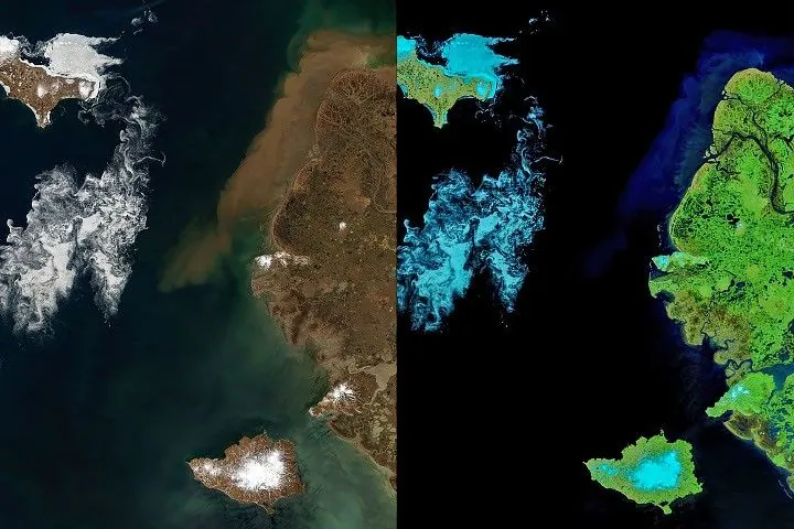
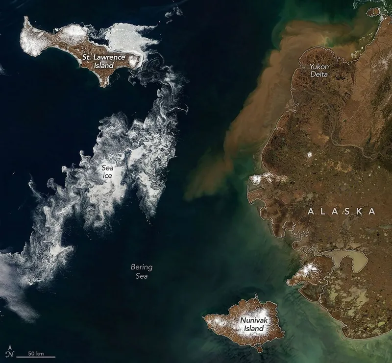
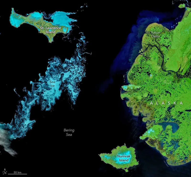
Sea ice fragments drift near Alaska’s Saint Lawrence and Nunivak islands and colorful water surrounds the Yukon Delta in natural-color (left) and false-color (right) images acquired with the MODIS (Moderate Resolution Imaging Spectroradiometer) on NASA’s Terra satellite on June 3, 2026. NASA Earth Observatory images by Michala Garrison.
When clouds parted in early June 2026, satellites glimpsed hints of summer’s approach in the Bering Sea off Alaska’s coast. Sea ice, broken into small fragments, took a few final spins on its way to melting completely, while rivers swollen with snowmelt washed sediment and organic material out to sea.
These images, acquired with the MODIS (Moderate Resolution Imaging Spectroradiometer) on NASA’s Terra satellite on June 3, 2026, capture the seasonal transition. A false-color view of the area (right) brings out features of the landscape that are more subtle in the natural-color scene (left), as human eyes would see it. In false color, the tundra and marsh vegetation appear green, and ice-free rivers and thermokarst lakes are dark blue. Sea ice and snow, where they still linger, appear light blue.
Amid the seasonal phenomena playing out in the images stand Saint Lawrence and Nunivak islands. Both have volcanic origins and are among the largest islands in the United States. They contain extensive basaltic lava flows forming small shield volcanoes, along with other features such as cinder cones and maars, or low-lying volcanic craters.
Saint Lawrence Island lies about 150 miles (240 kilometers) directly south of the Bering Strait, separating Alaska and the Russian Far East. It is one of the few pieces of the land bridge that connected Asia and North America during the Pleistocene that remain above water. Pack ice persisted along the northeast side of the island in early June, while other sea ice drifted and curled into intricate patterns with the winds and currents. The smaller the ice fragments, the wispier their swirling patterns appear when observed by satellites.
Brownish water, likely containing a mixture of suspended sediment and colored dissolved organic matter, lines the coast of mainland Alaska. The colorful water appears to enter the sea around the Yukon Delta, a vast wetland where the Yukon River branches into many circuitous channels. Sediment concentrations in this area typically increase starting in late May or early June. That’s after river ice has broken up and runoff from rain and snowmelt carries eroded material downstream.
NASA Earth Observatory images by Michala Garrison, using MODIS data from NASA EOSDIS LANCE and GIBS/Worldview. Story by Lindsey Doermann.
Downloads
June 3, 2026: Natural color
JPEG (2.37 MB)
June 3, 2026: False color
JPEG (2.56 MB)
References & Resources
- Alaska Volcano Observatory, Nunivak Island. Accessed June 18, 2026.
- Chikita, K. A., et al. (2021) Effects of River Discharge and Sediment Load on Sediment Plume Behaviors in a Coastal Region: The Yukon River, Alaska and the Bering Sea. Hydrology, 8(1), 45.
- NASA Earth Observatory (2021, June 21) Yukon-Kuskokwim in Colorful Transition. Accessed June 18, 2026.
- NASA Earth Observatory (2008, February 14) Sea Ice in the Bering Strait. Accessed June 18, 2026.
- Patton, W.W., et al. (2011) Geologic map of Saint Lawrence Island, Alaska. U.S. Geological Survey Scientific Investigations Map 3146.
You may also be interested in:
Stay up-to-date with the latest content from NASA as we explore the universe and discover more about our home planet.
A Changing World for Emperor Penguins
7 min read
Experts are analyzing decades of images from Landsat satellites for clues about how the iconic birds have responded to sea…
Article
Pink Penguin Guano Provides Diet Clues
3 min read
The color of Adélie penguin droppings reveals what the birds are eating, offering scientists a way to track how sea…
Article
An Uncommon Drifter in the Denmark Strait
4 min read
A large iceberg, observed in summer 2026, had drifted more than 1,000 kilometers south from the northeastern Greenland bay where…
Article
1
2
3
4
Next
Keep Exploring
Discover More from NASA Earth Science
Subscribe to Earth Observatory Newsletters
Subscribe to the Earth Observatory and get the Earth in your inbox.
Earth Observatory Image of the Day
NASA’s Earth Observatory brings you the Earth, every day, with in-depth stories and stunning imagery.
Explore Earth Science
Earth Science Data
Open access to NASA’s archive of Earth science data
Source: NASA Science