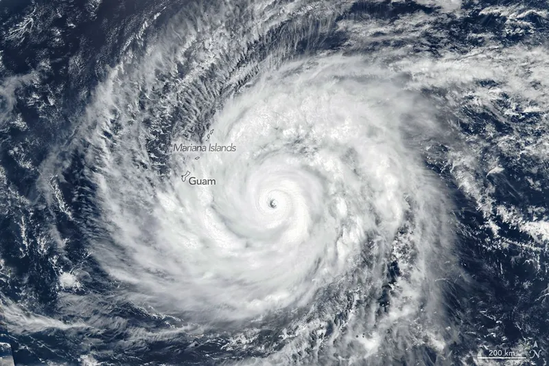
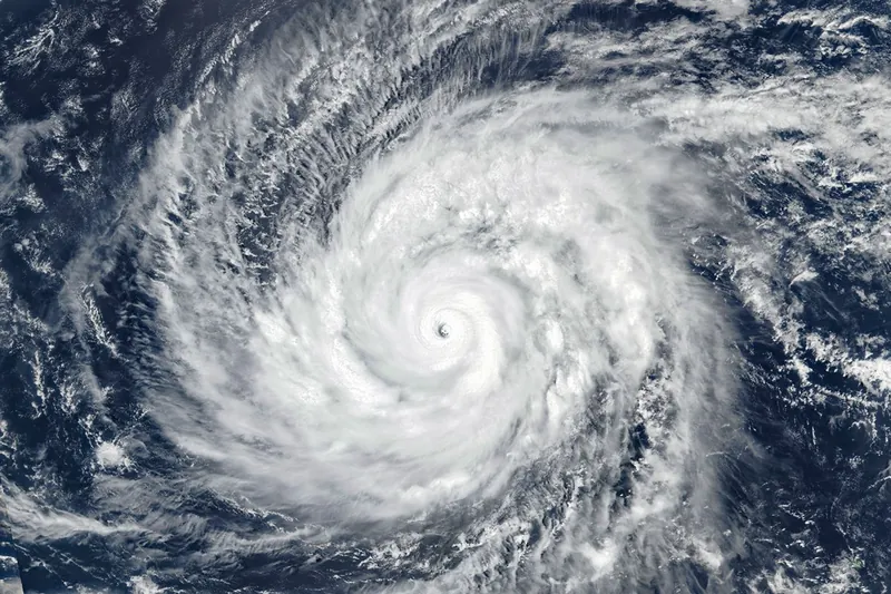
In mid-April 2026, a powerful typhoon bore down on the Mariana Islands in the North Pacific Ocean. The storm, Super Typhoon Sinlaku, was notable for reaching such exceptional strength so early in the year.
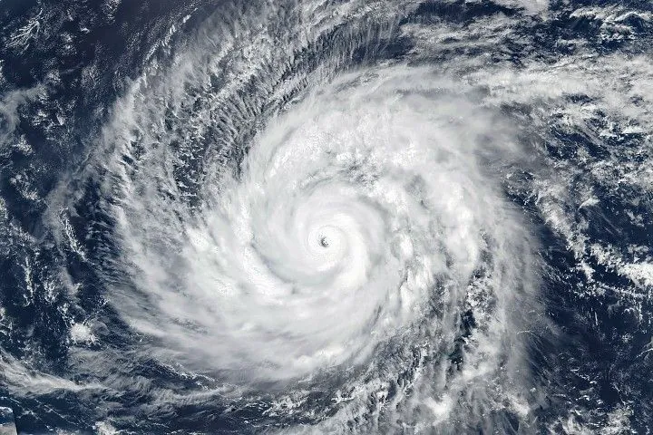
The VIIRS (Visible Infrared Imaging Radiometer Suite) on the Suomi NPP satellite captured this image at about 03:30 Universal Time (1:30 p.m. local time) on April 13, 2026, as Sinlaku approached the islands. At the time, the storm carried sustained winds of around 280 kilometers (175 miles) per hour. That places it as a violent typhoon—the highest intensity on the scale used by the Japan Meteorological Agency and equivalent to a category 5 storm on the Saffir-Simpson wind scale.
The storm continued along its northwest track toward the Marianas on the morning of April 14, as storm bands began to bring heavy rain to the islands of Saipan, Tinian, and Rota, according to an update from the National Weather Service. Forecasts called for typhoon conditions to affect Saipan and Tinian from April 14 into April 15 before subsiding to tropical storm conditions.
Though Super Typhoon Sinlaku occurred in the troposphere, the lowest layer of the atmosphere, it formed gravity waves that were visible much higher. The VIIRS (Visible Infrared Imaging Radiometer Suite) on the NOAA-20 satellite captured this nighttime image of the concentric waves made visible in the mesosphere by airglow.
Sinlaku is the second category 5 tropical cyclone of 2026, following Horacio, which churned over the South Indian Ocean in late February. Meteorologists note that Sinlaku is also one of only a handful of category 5 typhoons—a tropical cyclone that occurs in the Northwestern Pacific Ocean—known to have occurred so early in the year.
Meanwhile, several other storms spun over the planet’s oceans. On April 10, Tropical Cyclone Maila rotated in the opposite direction across the equator, and on April 12, Tropical Cyclone Vaianu crossed New Zealand’s North Island.
NASA Earth Observatory image by Michala Garrison, using VIIRS data from NASA EOSDIS LANCE, GIBS/Worldview, and the Suomi National Polar-orbiting Partnership. Story by Kathryn Hansen.
Downloads
April 13, 2026
JPEG (2.47 MB)
References & Resources
- CIMSS Satellite Blog (2026, April 12) Super Typhoon Sinlaku rapidly intensifies to a Category 5 storm. Accessed April 13, 2026.
- Japan Meteorological Agency (2026, April 13) Tropical Cyclone Information. Accessed April 13, 2026.
- Joint Typhoon Warning Center (2026, April 13) Super Typhoon 04W (Sinlaku) Warning #20. Accessed April 13, 2026.
- National Weather Service (2026, April 14) Zone Forecast for Guam and the Northern Marianas. Accessed April 13, 2026.
- Yale Climate Connections (2026, April 12) Cat 5 Super Typhoon Sinlaku the 2nd-strongest typhoon so early in the year. Accessed April 13, 2026.
- Yale Climate Connections (2026, February 23) Tropical Cyclone Horacio: Earth’s first Category 5 tropical cyclone of 2026. Accessed April 13, 2026.
You may also be interested in:
Stay up-to-date with the latest content from NASA as we explore the universe and discover more about our home planet.
Super Typhoon Bavi
3 min read
The third category 5 tropical cyclone of 2026 crossed the U.S. Northern Mariana Islands and Guam before continuing toward Asia.
Article
Typhoon Jangmi
2 min read
The sprawling storm promised to deliver torrential rain across a wide swath of southern Japan.
Article
Gravity Waves From Super Typhoon Sinlaku
4 min read
Satellites observed striking upper-atmosphere phenomena generated by an intensifying tropical cyclone.
Article
1
2
3
4
Next
Keep Exploring
Discover More from NASA Earth Science
Subscribe to Earth Observatory Newsletters
Subscribe to the Earth Observatory and get the Earth in your inbox.
Earth Observatory Image of the Day
NASA’s Earth Observatory brings you the Earth, every day, with in-depth stories and stunning imagery.
Explore Earth Science
Earth Science Data
Open access to NASA’s archive of Earth science data
Source: NASA Science