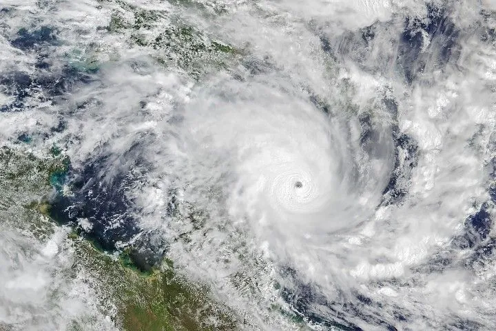
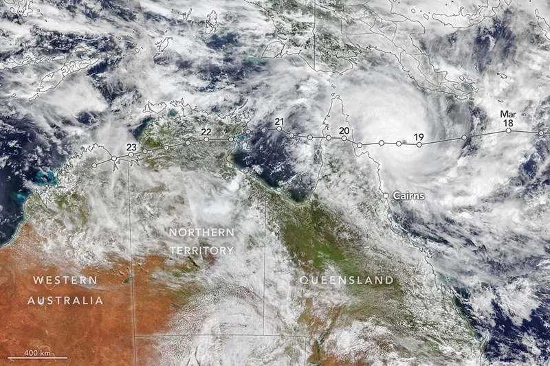
Tropical Cyclone Narelle traced a long path across the northern edge of Australia, bringing damaging winds and rain to areas already saturated with abundant precipitation. The system made separate landfalls in three different states and territories between March 20 and 23, 2026.
These satellite images show Narelle at about 2 p.m. local time (04:00 Universal Time) on March 19. By that time, the tropical cyclone was poised to make its first and most powerful landfall after intensifying over the Coral Sea. Sea surface temperatures along its path were 0.5–1.0 degrees Celsius above average, experts noted, which helped fuel its rapid intensification.
As it approached Queensland, the storm intensified to a category 5 on Australia’s tropical cyclone scale with maximum sustained winds up to 225 kilometers (140 miles) per hour—equivalent to a category 4 hurricane on the Saffir-Simpson wind scale. However, because Narelle’s structure was compact by cyclone standards, the most damaging winds extended a relatively short distance from its core. Narelle reached the Cape York Peninsula, a sparsely populated region in northern Queensland, on the morning of March 20.
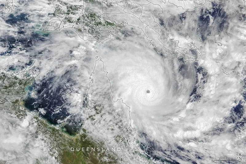
Narelle re-emerged over the Gulf of Carpentaria as a weakened cyclone, and wind speeds continued to decline as it neared the Northern Territory’s coast. The storm made its second landfall on the afternoon of March 21 with maximum sustained winds up to 148 kilometers (92 miles) per hour. It traversed the territory’s “Top End” until March 22.
More than 100 millimeters (4 inches) of rain fell across a wide area of the Northern Territory during Narelle’s passage, according to news reports. Australia’s Bureau of Meteorology (BOM) warned of minor to major flooding of several rivers. The storm arrived amid a severe wet season in the region that had already caused damaging floods and prompted evacuations.
After exiting the Northern Territory, the storm briefly crossed water and reached the northern Kimberley region of Western Australia as a tropical low on March 23. Even after Narelle’s multiple strikes in northern Australia, the storm may keep going. On March 23, the BOM said Narelle could potentially re-intensify into a tropical cyclone off the coast of Western Australia, curve south, and track along the coastline toward Perth.
Cyclones with several landfalls on mainland Australia are rare but not unheard of. In 2005, Ingrid followed a similar path to Narelle. That “triple-strike” storm, however, made landfall each time as a category 3 tropical cyclone or higher.
NASA Earth Observatory images by Michala Garrison, using VIIRS data from NASA EOSDIS LANCE, GIBS/Worldview, and the Joint Polar Satellite System (JPSS). Story by Lindsey Doermann.
Downloads
March 19, 2026
JPEG (2.66 MB)
March 19, 2026, detail
JPEG (1.96 MB)
References & Resources
- Australian Broadcasting Corporation (2026, March 17) Cyclone Narelle could be the first storm in 21 years to make landfall three times. Accessed March 23, 2026.
- Bureau of Meteorology, via YouTube (2026, March 23) Severe Weather Update 23 March 2026: Ex-Tropical Cyclone Narelle impacting WA this week. Accessed March 23, 2026.
- The Conversation (2026, March 19) Cyclone Narelle: ‘compact’, dangerous and unusually predictable. Accessed March 23, 2026.
- The Guardian (2026, March 22) Saturated NT braces for Tropical Cyclone Narelle to dump another 300mm of rain. Accessed March 23, 2026.
- The New York Times (2026, March 19) Remote Part of Australia Braces for ‘Significant’ Tropical System. Accessed March 23, 2026.
- Weather Underground (2026, March 23) Tropical Cyclone Narelle. Accessed March 23, 2026.
You may also be interested in:
Stay up-to-date with the latest content from NASA as we explore the universe and discover more about our home planet.
Lala Batters Hawaii
3 min read
The powerful storm delivered extreme rainfall and damaging winds to the state, passing the Island of Hawaiʻi as a category…
Article
Explosive Intensification for Hurricane Polo
5 min read
Several ingredients came together off the Pacific coast of Mexico to generate one of the strongest storms the eastern Pacific…
Article
Powerful Storms Continue to Prowl the Pacific
4 min read
Hurricanes Polo and Nolo sent destructive effects ashore amid an active season in the northeastern and central Pacific.
Article
1
2
3
4
Next
Keep Exploring
Discover More from NASA Earth Science
Subscribe to Earth Observatory Newsletters
Subscribe to the Earth Observatory and get the Earth in your inbox.
Earth Observatory Image of the Day
NASA’s Earth Observatory brings you the Earth, every day, with in-depth stories and stunning imagery.
Explore Earth Science
Earth Science Data
Open access to NASA’s archive of Earth science data
Source: NASA Science